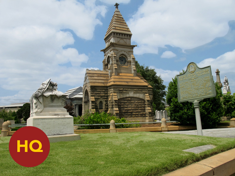
![HQ STOP: "Hood's Headquarters Site (Oakland Cemetery)" [2013]](https://inheritagealmanack.org/wp-content/uploads/2016/08/almanack-battle-atlanta-hq-hood-600x400.jpg "almanack-battle-atlanta-hq-hood")
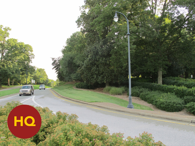
![HQ STOP: "Sherman's Headquarters Site, Augustus Hurt House (Carter Presidential Center)" [2013]](https://inheritagealmanack.org/wp-content/uploads/2016/08/almanack-battle-atlanta-hq-sherman-600x400.jpg "almanack-battle-atlanta-hq-sherman")
![STOP 20: "Stevenson's Division (Cheatham's Corps) Attacks; Repulsed (Memorial Drive)" [2004]](https://inheritagealmanack.org/wp-content/uploads/2016/08/almanack-battle-atlanta-20-stevenson-attack-600x400.jpg "almanack-battle-atlanta-20-stevenson-attack")
![STOP 21a: "Benton's / Coltart's Brigades (Brown's Division) Advance (Reynoldstown)" [2012]](https://inheritagealmanack.org/wp-content/uploads/2016/08/almanack-battle-atlanta-21a-benton-coltart-600x400.jpg "almanack-battle-atlanta-21a-benton-coltart")
![STOP 21b: "Initial Position of Harrow's Division (Reynoldstown)" [2012]](https://inheritagealmanack.org/wp-content/uploads/2016/08/almanack-battle-atlanta-21b-harrows-line-600x400.jpg "almanack-battle-atlanta-21b-harrows-line")
![STOP 22: "Brown's and Clayton's Divisions Advance (Inman Park @ Delta Point)" [2004]](https://inheritagealmanack.org/wp-content/uploads/2016/08/almanack-battle-atlanta-22-brown-clayton-600x400.jpg "almanack-battle-atlanta-22-brown-clayton")
![STOP 23a: "Brown's Division closes on U.S. XV Corps line (along Edgewood Avenue)" [2004]](https://inheritagealmanack.org/wp-content/uploads/2016/08/almanack-battle-atlanta-23a-brown-springvale-600x400.jpg "almanack-battle-atlanta-23a-brown-springvale")
![STOP 23b: "Brown's Division closes on U.S. XV Corps line (south Springvale Park)" [2004]](https://inheritagealmanack.org/wp-content/uploads/2016/08/almanack-battle-atlanta-23b-brown-springvale-600x400.jpg "almanack-battle-atlanta-23b-brown-springvale")
![STOP 24: "Advance of Cheatham's Left, Clayton's Division (north Springvale Park)" [2004]](https://inheritagealmanack.org/wp-content/uploads/2016/08/almanack-battle-atlanta-24-baker-clayton-600x400.jpg "almanack-battle-atlanta-24-baker-clayton")
![STOP 25a: "Site of Widow Pope House (Inman Park / Reynoldstown MARTA Station)" [2004]](https://inheritagealmanack.org/wp-content/uploads/2016/08/almanack-battle-atlanta-25a-widow-pope-600x400.jpg "almanack-battle-atlanta-25a-widow-pope")
![STOP 25b: "Advance of Cheatham's Center / Railroad Cut (DeKalb Avenue Corridor)" [2004]](https://inheritagealmanack.org/wp-content/uploads/2016/08/almanack-battle-atlanta-25b-railroad-cut-600x400.jpg "almanack-battle-atlanta-25b-railroad-cut")
![STOP 25c: "Manigault's Brigade Breaks Through XV Corps Line (Dekalb Avenue @ DeGress)" [2004]](https://inheritagealmanack.org/wp-content/uploads/2016/08/almanack-battle-atlanta-25c-manigault-breakthrough-600x400.jpg "almanack-battle-atlanta-25c-manigault-breakthrough")
![STOP 25d: "Manigault's Brigade Breaks Through XV Corps Line (Dekalb Avenue @ DeGress)" [2004]](https://inheritagealmanack.org/wp-content/uploads/2016/08/almanack-battle-atlanta-25d-manigault-breakthrough-600x400.jpg "almanack-battle-atlanta-25d-manigault-breakthrough")
![STOP 26a: "Site of Troup Hurt House, Manigault's Breakthrough (DeGress Avenue)" [2004]](https://inheritagealmanack.org/wp-content/uploads/2016/08/almanack-battle-atlanta-26a-troup-hurt-600x400.jpg "almanack-battle-atlanta-26a-troup-hurt")
![STOP 26b: "Site of Manigault's Breakthrough (DeGress Avenue)" [2004]](https://inheritagealmanack.org/wp-content/uploads/2016/08/almanack-battle-atlanta-26b-degress-avenue-600x400.jpg "almanack-battle-atlanta-26b-degress-avenue")
![STOP 26c: "Location of DeGress Battery, Confederate Breakthrough (north DeGress Avenue)" [2004]](https://inheritagealmanack.org/wp-content/uploads/2016/08/almanack-battle-atlanta-26c-degress-battery-600x400.jpg "almanack-battle-atlanta-26c-degress-battery")
![STOP 27a: "Routed Remnants of Smith's Division Gather (north-end of Edgewood Retail District—under construction)" [2004]](https://inheritagealmanack.org/wp-content/uploads/2016/08/almanack-battle-atlanta-27a-smiths-retreat-600x400.jpg "almanack-battle-atlanta-27a-smiths-retreat")
![STOP 27b: "Routed Remnants of Smith's Division Gather (north-end of Edgewood Retail District)" [2012]](https://inheritagealmanack.org/wp-content/uploads/2016/08/almanack-battle-atlanta-27b-smiths-retreat-600x400.jpg "almanack-battle-atlanta-27b-smiths-retreat")
![STOP 28: "Harrow's Division Fall-Back Line (south-end of Edgewood Retail District)" [2012]](https://inheritagealmanack.org/wp-content/uploads/2016/08/almanack-battle-atlanta-28-harrow-fallback-600x400.jpg "almanack-battle-atlanta-28-harrow-fallback")
![STOP 29: "Wood's Division Halts Clayton's Division & Counterattacks (north Inman Park, Freedom Parkway)" [2012]](https://inheritagealmanack.org/wp-content/uploads/2016/08/almanack-battle-atlanta-29-woods-line-600x400.jpg "almanack-battle-atlanta-29-woods-line")
![STOP 30a: "Logan's Counterattack Retakes XV Corps Positions (DeKalb Avenue Corridor)" [2012]](https://inheritagealmanack.org/wp-content/uploads/2016/08/almanack-battle-atlanta-30a-logan-counterattack-600x400.jpg "almanack-battle-atlanta-30a-logan-counterattack")
![STOP 30b: "Logan's Counterattack Retakes XV Corps Positions (DeKalb Avenue Corridor)" [2012]](https://inheritagealmanack.org/wp-content/uploads/2016/08/almanack-battle-atlanta-30b-logan-counterattack-600x400.jpg "almanack-battle-atlanta-30b-logan-counterattack")
![STOP 30c: "Logan's Counterattack Retakes XV Corps Positions (DeKalb Avenue Corridor)" [2012]](https://inheritagealmanack.org/wp-content/uploads/2016/08/almanack-battle-atlanta-30c-logan-counterattack-600x400.jpg "almanack-battle-atlanta-30c-logan-counterattack")
![STOP 30d: "Left of Smith's Division Counterattacks (front of Edgewood Retail District, Moreland Avenue)" [2012]](https://inheritagealmanack.org/wp-content/uploads/2016/08/almanack-battle-atlanta-30d-smith-counterattack-600x400.jpg "almanack-battle-atlanta-30d-smith-counterattack")
The most powerful attack of July 22, 1864, came from the center-left of Benjamin Cheatham’s corps-strength assault, the second phase of Hood’s plan. The C.S. division of John C. Brown plowed into and exploded the center of the U.S. XV Corps posted in a rectangle of land that includes parts of the modern Inman Park, Little Five Points, Reynoldstown and Edgewood neighborhoods. The peak of this fight—and the battle itself—is the epic scene depicted in Atlanta’s Cyclorama. If you were in a helicopter facing west and hovering about 40 feet above today’s Moreland / DeKalb Avenue interchange, you would have the same vantage point of this key moment as depicted in the famous in-the-round painting.
The advance of Cheatham’s Corps started in front of Atlanta’s inner-defense line, which ran north / south on the east-side of the city—generally following the route of modern Boulevard Avenue. The advance moved-out to the east over what was then a sparse area, the small city—home to about 10,000 residents at the time of the war—quickly tapering off into countryside. Today this area contains some of Atlanta’s most notable landmarks: Grant Park (which also contains Atlanta Zoo and The Battle of Atlanta Cyclorama), the beautiful haunting Oakland Cemetery (Hood observing the battle from the second-story of a house that once stood on the north side of the cemetery), the historic mill village known as Cabbagetown, the Martin Luther King, Jr. NHS (which also contains King’s childhood home and the historic Ebenezer Baptist Church), and Sweet Auburn (the most successful black neighborhood in the south during the early 20th century, prospering from within during the historical stain of Jim Crow-era segregation). On July 22, 1864, Cheatham’s Corps advanced across all of this area in making its assault on the U.S. XV Corps—their line, in turn, stretching from modern Memorial north to The Carter Center (another notable landmark). Along the routes that modern Euclid, Edgewood, DeKalb, Wylie, Kirkwood and Memorial now take, massed waves of Confederates soldiers marched into the fight.
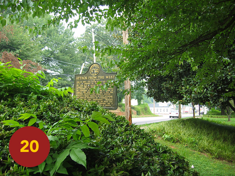
The first stop that documents Cheatham’s advance is west of Moreland Ave down Memorial at its cross with Stovall: STOP 20, the marker “Attack from the West.” (This marker stands in front of a fine, if now worn, example of early 20th-century public architecture, a grade-school built at a time when aesthetic expression in public buildings was much more a matter of civic pride). This marker records the advance of Cheatham’s right-wing: the regular Army of Tennessee division of Carter Stevenson with G. W. Smith’s Division of Georgia state militia in support. From this point north, all of the area now wedged in between I-20 and the CSX / MARTA lines, as many as four divisions marched forward—a solid guesstimate being 7-8000 men of Cheatham’s attacking force. This is the modern Reynoldstown neighborhood. Still a mix of working-class and middle-class-gentrified, it lacks the distinct commercial-cultural strip found in adjacent East Atlanta and Grant Park. This has made recovery more elusive than those neighborhoods surrounding it; a block-to-block, house-to-house battle. But with the bustling new Edgewood Retail District on its eastern boundary and renovation moving down the length of Memorial, its rejuvenation really seemed only a matter of time. None of that diminishes the fact: this is core battlefield land, the history embedded here—evident in streets named for Confederate generals: Brantley, Manigault, Holtzclaw, Cumming, Wathall, Stovall.
Cheatham’s right ran headlong into a determined and more confident Union line. Anchored by the stalwart defenses up on Bald Hill, the ranks of Leggett’s Division recently involved in halting Cleburne’s plunge into the gap (most notably Manning Force’s brigade), changed front back to the west and poured fire on Stevensons’ advancing ranks. This “attack from the west” gained no ground against the compact strengthened defense of Leggett’s Division, supported on right by the left-most elements of Harrow’s Division and now supported on their left by the regrouped line of Smith and Wangelin’s troops. The U.S. veterans who fought there would forever forward refer to Bald Hill as “Leggett’s Hill.”
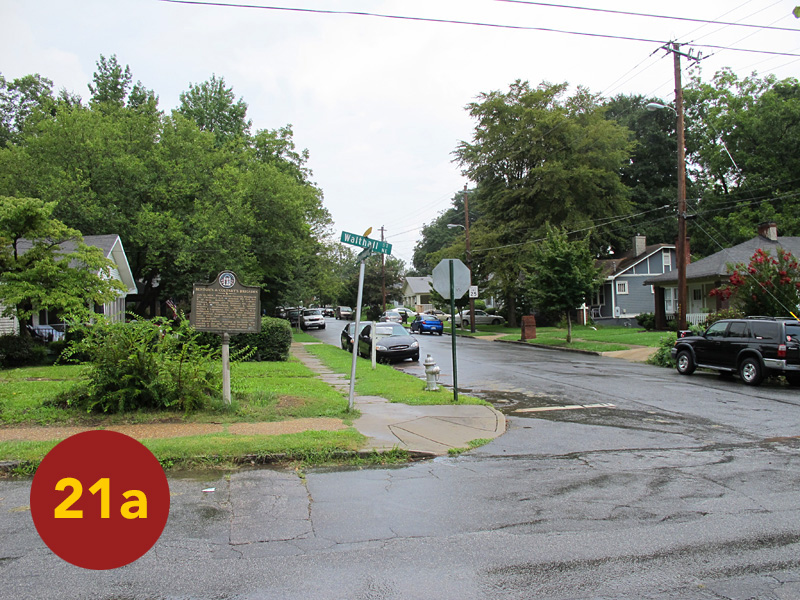
To the immediate north, Cheatham’s assault was packing a bigger punch and gaining ground. STOP 21 locates two historical markers along modern Boulevard Drive in Reynoldstown that documents the advance of the right of Brown’s C.S. Division. The first: “Harrow’s Division XV Corps,” notes the original position of the U.S. force that met the Confederate attack—their line running N x NW from Bald Hill to a point south of the Georgia Railroad line, and west of modern Moreland Avenue. Today, Harrow’s men would be defending a part of the sprawling Edgewood Retail District: a commercial village unto itself mixing faux store-front retail in with big-box chain stores (all of which was in the early stages of construction during our 2004 tour). At the time of the battle, the area east of Moreland today from the shopping complex south to Memorial included: wheat-fields, a tannery, possibly a distillery (according to William Scaife’s map), some additional fields and forest. Back in Reynoldstown and further up Boulevard Drive at its cross with Wathall stands the second marker: “Benton’s & Coltart’s Brigades.” This was half of Brown’s Division which, having charged east along the south-side of the GA-RR, slammed into Harrow’s men. This left-most division of the U.S. XV Corps line wavered and momentarily held, but was forced to fall back (throughout the area east of modern Moreland just described) with what would come next … An amusing interlude: as I was snapping a shot of the latter marker during the hot mid-afternoon of our tour on July 22, 2004, a guy, looking tired, walked by. We exchanged hellos, said he was glad to be going home after work. As I was walking back to the truck to mount-up for our next stop, I heard him say to someone across the street: “Him? He’s one of those history guys. You know? A history guy.” There only to record the marker, I was a conspicuous presence to the normal routine of Reynoldstown. I took my new moniker as a badge-earned.
* * *
In 1864 the Georgia Railroad was an east-west line running through Atlanta. Having crept inland from Augusta in the 1830s, this line was THE commerce / transportation source into the interior from Savannah, Charleston, and the rest of the south-Atlantic coast. It was the reason Atlanta (once called Terminus, when it briefly marked the railroad’s end) came into existence. This point became a natural convergence for commercial trade. As a result, the small piedmont city had by 1864 become the most important inland transfer-hub in the deep South (140 years later, the “hub” tradition continues: Atlanta’s Hartsfield-Jackson Int’l Airport routinely one of the busiest in the world, while Atlanta’s downtown hosts the junction of three major interstates: I-20 / I-75 / I-85) … On July 22, 1864, the same Georgia Railroad line, and more so the cut it made through a small rise one hundred yards west of the modern Moreland / DeKalb Avenue interchange, became the most important point on the entire field of battle.
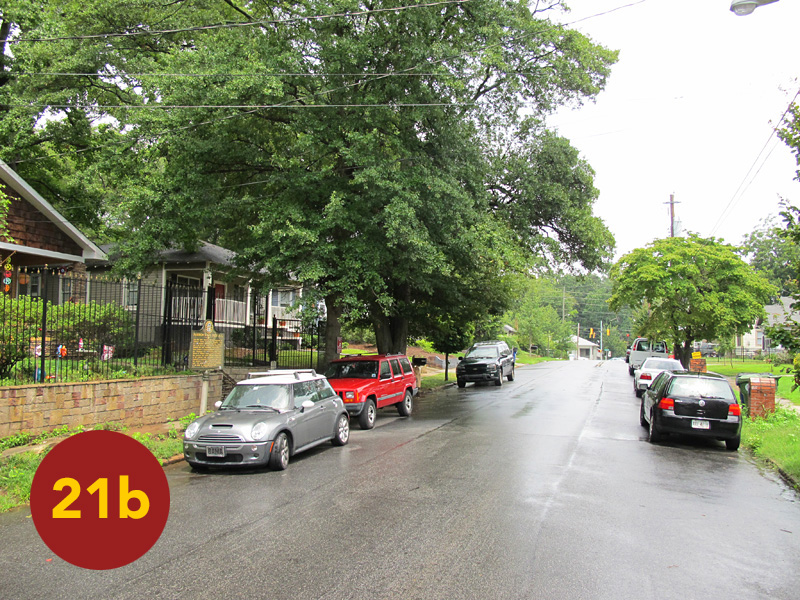
I have lived within view or earshot of the modern version of the GA-RR (operated by shipping giant CSX) at all five addresses I have called home in Atlanta. I was never closer than the 1920s Craftsman-era duplex that Kerri & I rented off Edgewood Avenue in Inman Park. Across our front-yard and the entire vicinity where Euclid and Edgewood Avenues meet alongside a small delta-shaped park, the battle lines of John C. Brown’s Division rolled forward. Just as Carter Stevenson’s assault was being repelled by the U.S. XVII Corps on Bald Hill, Brown’s men came crashing into—and at the railroad cut—through the U.S. XV Corps. Here victory or defeat would be determined … We recall our year at Delta Place in Inman Park (1997-98) with ‘magnolia-scented’ nostalgia. I attach special meaning to the time that we spent there; as that is when I began to piece together The Battle of Atlanta in relation to the city I knew, one historical marker at-a-time. I was able to literally start in our front yard … STOP 22: Delta Point Park and the marker: “Brown’s and Clayton’s Divisions.”
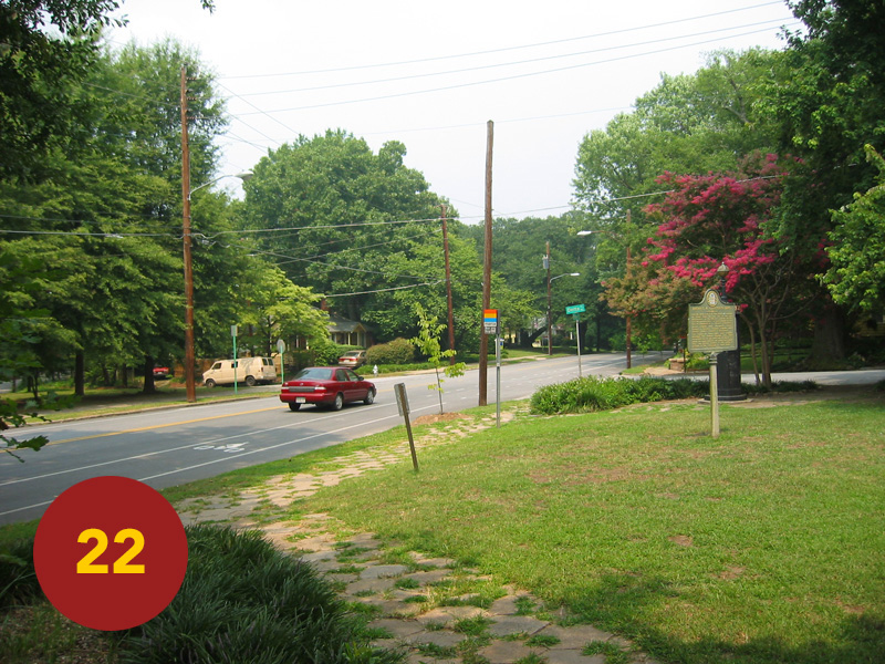
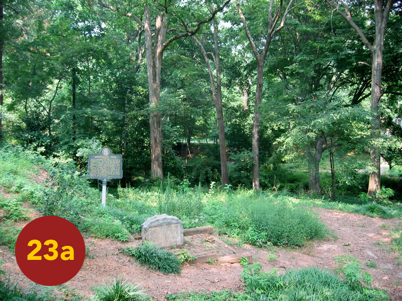
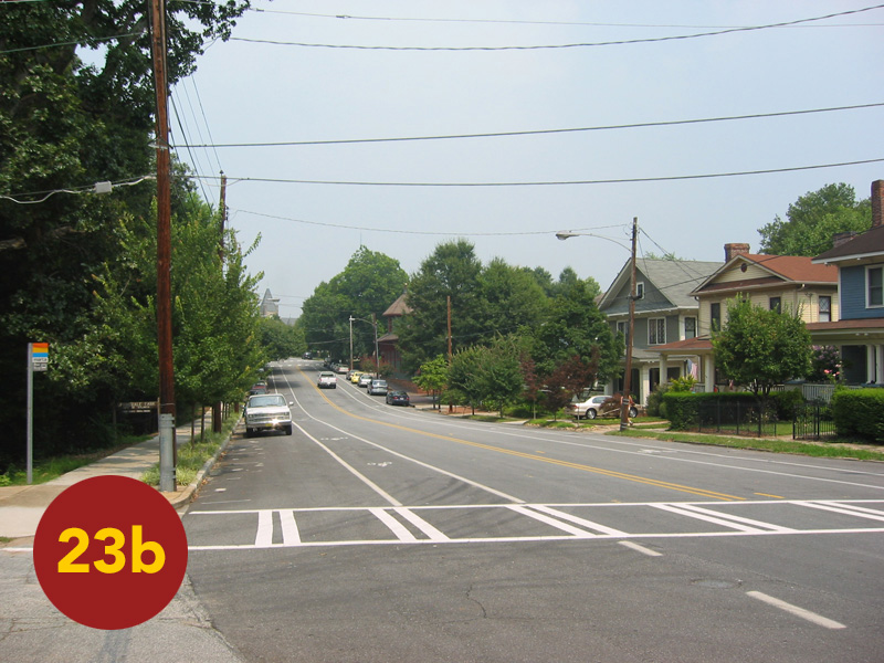
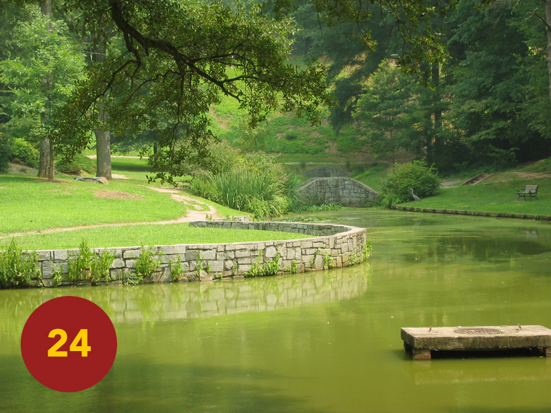
Aside from Patrick Cleburne’s Division, Brown’s Division at the center of Cheatham’s Corps made the most formidable attack of the day. The brigade of Arthur Manigault, Brown’s left-wing, brought the Confederates as close to victory as they would come. In parallel with Coltart’s and Benton’s brigades on their right and south of the tracks, Manigault’s men marched in the same direction that Edgewood / DeKalb Avenues take today—DeKalb being the same general road-bed as the war-era Decatur Wagon Road. Along with Collier Road in north Atlanta’s Buckhead neighborhood (frontline of The Battle of Peachtree Creek), this stretch of road east to its intersection with Moreland Ave contains as dense a concentration of state historic markers as anywhere in Georgia. They record this phase of the battle in great detail … But prior to exiting onto DeKalb, two stops at either end of Springvale Park—a natural ravine transformed in the 1890s by landscape-architect, Frederick Law Olmstead, Jr., into the centerpiece of the Inman Park neighborhood—records the advancing columns as they passed through. STOP 23 lies on the north—manicured—end of the park. It locates the marker: “Baker’s Brigade” and Henry Clayton’s Division, the far-left-flank of Cheatham’s assaulting force. STOP 24 is on the south-end of the park, this half between Euclid Avenue and Edgewood left as a purposeful nature preserve. Near Waverly Place / Edgewood stands a marker noting the ravine’s importance: both divisions pausing here, out of the way of a hot-fire then pouring from the U.S. XV Corps line, in order to reorganize for the last deadly leg of their approach. Beneath the state marker is a stone marker placed by a local SCV chapter that, for some reason, reiterates the history documented by the marker. Along with a few interpretive signs placed by the Georgia Battlefields Association in the early-2000s (poorly constructed and weathering rapidly), these are the only non-state markers one will find.
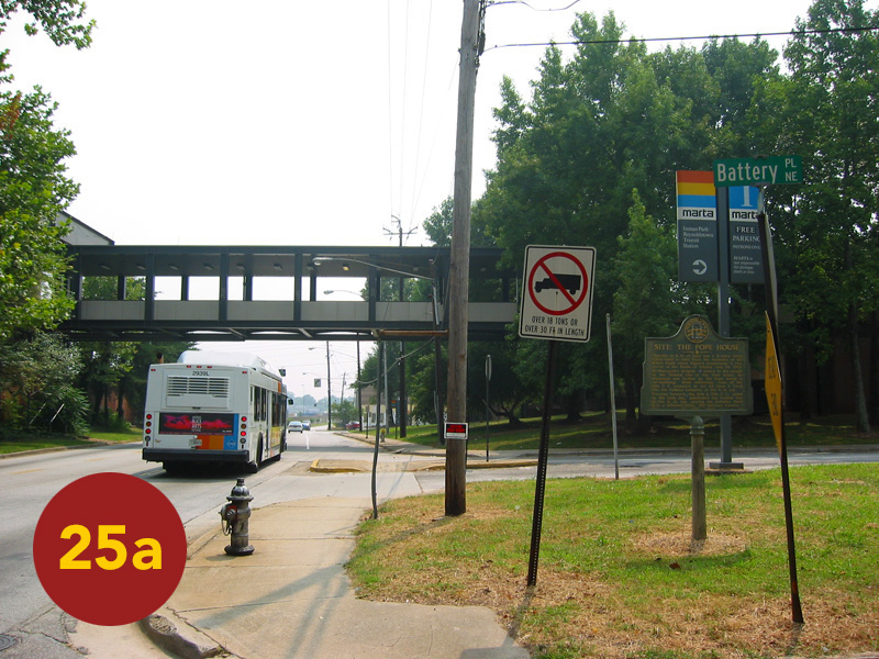
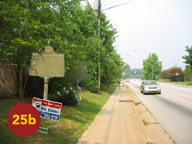
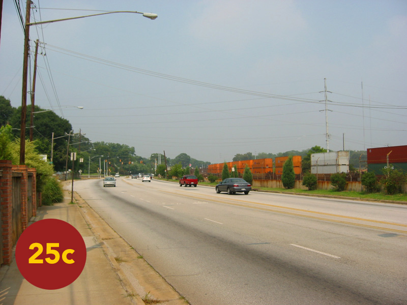
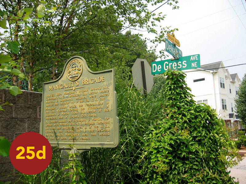
As soon as Cheatham’s ranks were within range, Union artillery opened on the massed columns. This spread thick suffocating clouds of smoke over the entire north-end of the field. Every large-scale battle of the Civil War was fought within this choking fog, the discharge of powder-fired rifles and cannon to the tune of hundreds-of-thousands of rounds per fight. Obscurity and confusion often reigned. Large-scale troop movements were very difficult once engaged. Yet reciprocally, this allowed movements—large and small, if lucky and performed quickly—to gain ground without detection. Such was the case on that late afternoon in 1864. Manigault’s men came up on the “Widow Pope” house, a conspicuous white structure that stood near the parking lot of today’s Inman Park / Reynoldstown MARTA station. STOP 25 locates the “white house,” as Kurtz and others refer to it, and the several markers related to the advance. (Once placed in linear succession, as on the day of our 2004 tour, the markers in a very poor decision by transportation officials have recently been bunched together. Having removing linear context from the story being told, I urge you to read the markers in the following succession.) The marker “Site of the Pope House” documents the first-step in the final assault. From the second-story of the Pope House, sharpshooters played havoc on the Union line only a few hundred yards to their front. U.S. artillery opened on the house with a vengeance. The barrage fully enveloped the field in smoke. Under the cover the smoke provided, the lead C.S. brigades of Stovall (Clayton’s Division), Manigault, Coltart and Benton pitched forward into the U.S. divisions of Morgan Smith (brother of Giles) and William Harrow, respectively. Of them all, Manigault’s brigade—advancing on a compact front with their right running the course of the GA-RR line—packed the most powerful punch. A portion of Manigault’s men found the railroad cut and raced down it. They emerged in the rear of Joseph Lightburn’s U.S. brigade (Smith’s Division). Aligned in parallel to and dug in to the immediate west of modern DeGress Avenue, Lightburn’s troops fought desperately to beat back the onslaught materializing, seemingly, out of the smoke itself. But the Southern tide turned into a flood. Overwhelmed in front and outflanked on their left, Lightburn’s brigade—and as a result, the center of XV Corps—dissolved. It was a precipitous collapse and Manigault’s men exploded into the gap. Lt. R. M. Gill of Mississippi wrote: “we charged with an awful yell but few Yankees staid [sic] to see the racket.”
The marker: “The XV Corps Sector,” notes the original position of the U.S. XV Corps; with the final leg of the Confederate advance and breakthrough being told by the markers: “The Railroad Cut” and “Manigault’s Brigade.” All of this occurs along the span of just a short walk: from the MARTA station down the sidewalk of DeKalb (and past the “Battery Place” condominium complex) to DeGress Avenue. Here, Cheatham’s assault broke through. Not quite as active as the I-20 / Moreland interchange, it is nonetheless a busy place … In keeping to the historical accuracy of timing our stops on our July 22, 2004 tour, we made this leg right about 4 p.m.—just as the first vestige of Atlanta’s notorious rush-hour was gearing up. Traffic-light regulated spurts of traffic blew by, moving the thick air but slightly. The wet-blanket of humidity was by that point oppressive. It seemed impenetrable, the sky more grey than blue. I recall wondering how deep casualty lists of the Civil War ran with those who died from heatstroke alone, a fate unrecorded in those days. Historical accounts place the temperature of July 22, 1864, close to the same as the day of our tour. By my accounts that means it was hot-as-hell … Today, 4-5 p.m. on a weekday views the steady increase of traffic build up to a peak along DeKalb Ave. Between 4-5 p.m. on Friday, July 22, 1864, The Battle of Atlanta was decided in the very same place.
The last stand of the XV Corps’ center was that of an Illinois battery of artillery commanded by Francis DeGress. With infantry support evaporating, DeGress ordered the bulk of his artillerymen to retreat. He and a small crew remained firing point blank charges of canister into the approaching Confederate tide … A coffee-can shaped ordnance filled with dozens of small metal slugs, the round was designed to explode like a giant sawed-off shotgun shell when fired, the effect on advancing infantry horrific … As rapidly as they could load, those left fired round-after-round into the wall of Confederates pouring out of the smoke on their position. They began doubling up the rounds per shot. But even canister could not halt the breakthrough. Their fate clear, the few artillerists left ‘spiked’ their guns (a last-ditch tactic that render cannon temporarily inoperable when they had to be left to the enemy) and ran off. The attackers were so close, that a C.S. officer ordered DeGress to surrender. As claimed, his response was to take hold of the lanyards of two loaded cannon and fire them both. The young captain fled behind the resulting smoke and carnage and, remarkably, escaped—going directly to Sherman at field headquarters to report of the loss. Not all of his men were so lucky. But this selfless stand only delayed the inevitable. The Confederates had broken through. Arthur Manigault’s brigade, followed swiftly by Sharp’s and later Holtzclaw’s (commanded that day by Bushrod Jones) brigade poured into the breach.
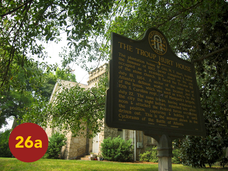
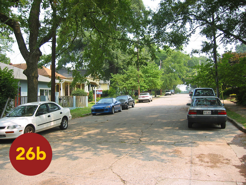
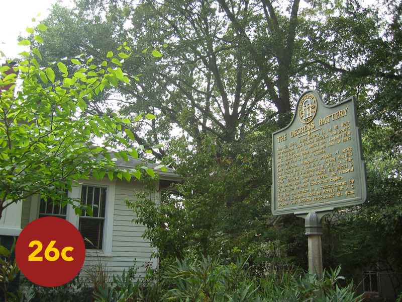
DeGress Avenue off of DeKalb is an inviting quiet side-road lined of early-twentieth century homes and large shade trees. STOP 26 runs from the DeGress outlet down to the Moreland / DeKalb intersection, but includes all DeGress in the process. DeGress takes a north-south course and runs just behind where the entrenched line of Lightburn’s U.S. brigade was overrun. Halfway up DeGress stands a beautiful century-old stone church (now a private residence). On this site in 1864 sat the unfinished “Troup Hurt House,” a summer-residence to-be of the brother of Augustus Hurt. Standing on the sidewalk in front of the marker in the property’s front yard places you in the centre of the epic scene of the Confederate breakthrough as depicted in The Cyclorama. Across this quiet niche of Inman Park, the final bloody scene of the battle was played out. At the north end of the street, the marker: “DeGress Battery” stands in the front yard of a small house. Certainly one of the more historically-relevant front yards in Atlanta, the location of the marker—and the event it records—is a perfect allegory for the battlefield and what has come since: residences, front-and-back yards, condos, apartments, villages, transit-stations, parking lots, commercial and entertainment districts, residential and surface streets, main state routes, highways, interchanges. Despite a preservationist’s zeal to see every acre of core battlefield land preserved for eternity (or at least left alone, undeveloped), my journalistic urge to document ‘the modern’ where that is not the case takes on more personal significance each time I edit this documentary; and standing in front of the “DeGress Battery” marker, it is apparent why. History is a layered canyon. To cover a single-event only, is to fail the continually-evolving narrative of the larger-surround of history itself. Some places, stories and events are relatively static. That is not the case here. And though Atlanta’s east-side is today defined more by the intermingled complexity of quiet side-roads and bustling thoroughfares than by the battle that blew across all of it, here lies the answer to that question I asked myself many years back. Q: “how to tell this story?” A: “place readers into the flow of this battle by stitching it directly into the context of what has come since, what we all know Atlanta to be — today” … To this end, I soldier on.
The pleasant sidewalk stroll down DeGress is one of the key ironies of touring this “battlefield,” so peaceful a walk layered over the dark history of men fighting-to-the-death in scratchy wool uniforms beneath the furnace-like heat of a southern summer afternoon; or the equally ‘pleasant’ thought of a canister round exploding in your face and, rendered unable to move from the pain of your wounds, being left to bleed-to-death far from home. No, not at all pleasant. But this was the reality of the soldiers who fought—and died—on this very ground. It is a place embedded with human tragedy; and yet today, it serves up one relaxing stroll down a beautiful lane … Back out on DeKalb, you stand in as historic a location as you can find anywhere in this city. Just before DeKalb crosses over Moreland there is a small sliver of land that is fenced off. Within it stands a marker that locates the position of a Union signal station during the battle. The telegraph, though popular during the Civil War, was still a cumbersome thing when mobility was required. Signal flags, relaying a precursor to Morse code, were often used from towers or more likely hilltops to relay messages over long visible distances in ‘liquid’ situations—such as campaigning or during a battle. Yet the more significant history embossed on this marker is in noting the nearby location of a 40-foot tall tower erected for artists nearly twenty years after the battle. From this vantage point the German-recruited employees of Milwaukee-based: American Panorama Co. researched and sketched the surrounding landscape (which had changed little since the battle) for the mammoth and soon to be world-famous in-the-round painting.
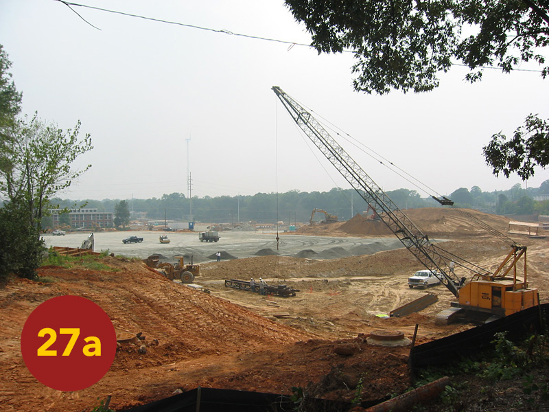
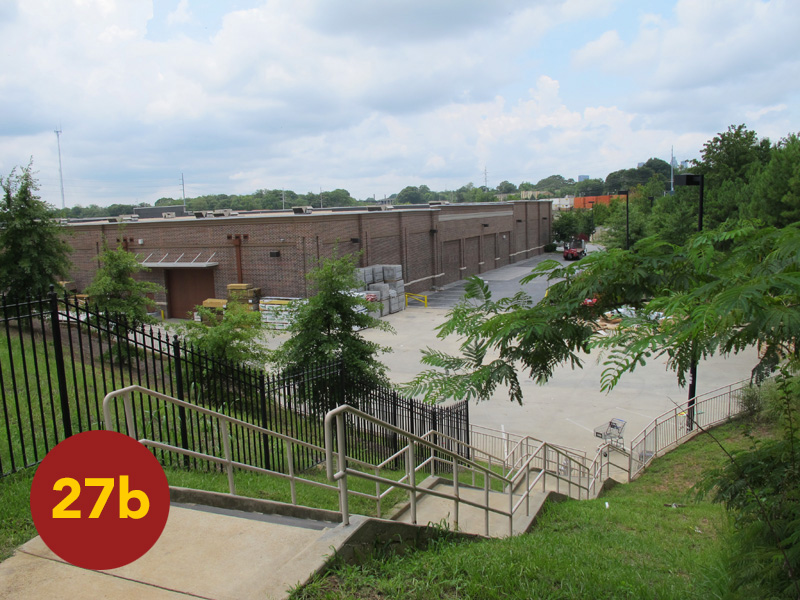
Back to the battle: the right of Brown’s Division—Coltart’s and Benton’s brigades—having pitched forward into the left-regiments of Morgan Smith’s Division and the core of William Harrow’s divisional line, met a more stingy defense. Harrow’s men successfully absorbed the initial shock of the attack. But with the disintegration of the center of Smith’s line, their right-flank was now exposed. The flank is STOP 27: the north-end of the Edgewood Retail District. In 2004, the entire area that would be this complex was a long smooth field of red graded earth awaiting construction (most all of it having previously been service buildings and fleet vehicle lots for the Atlanta Gaslight Company). When matched to The Cyclorama, this area just south of today’s DeKalb Ave and the CSX / MARTA lines contains the disoriented and dazed survivors of Lightburn’s brigade. Having retreated in haste, the portion of this broken force that remained on the field fell back to the vicinity of the mentioned wheat fields. They were quickly reorganized, for the fight was not near to being over. They would be fed in to support the powerful Union counterattack that everyone—certainly the Confederates in the breach—had to know was coming.
* * *
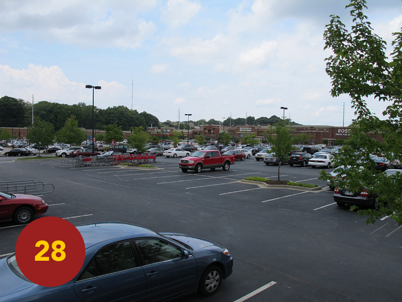
Slowly, grudgingly, Harrow’s Division had swung back like a gate-door—hinging on Leggett’s iron defense atop Bald Hill. A difficult maneuver, especially under-fire, it had the desired effect of stalling the momentum of Brown’s Division south of the tracks just as Manigault’s brigade was breaking through Smith’s line north of the tracks … About half of this gate-like maneuver swept across the spread-out parking lots and complex of the Edgewood Retail District: STOP 28. This entire area—which pushes into the west side of the Edgewood neighborhood—is core battlefield land. To date, there is not a single mention amidst all the shops and big chain stores of the epic history that occurred where all of this commercial real estate now stands.
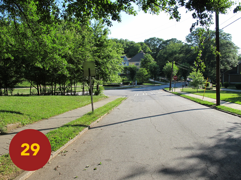
In conjunction with Harrow’s Division south of the breakthrough, Charles Woods’ Division—positioned on the right of the U.S. XV Corps line north of Smith’s Division (across modern Little Five Points / Inman Park up to Freedom Parkway), performed a similar organized fall-back before the rush of Clayton’s C.S. Division (the far-left of Cheatham’s Corps). STOP 29 locates their defense under the watchful eye of Sherman, and several batteries of artillery, atop the hill just behind them. Despite lacking a full brigade (Wangelin having been sent south to shore up the defense of Bald Hill) Wood’s men held a slight advantage in elevation and held firm. Along with Harrow’s troops south of the GA-RR, they helped contain the Confederate breakthrough—isolating the lodgment near what had been the center of their line … But the Confederates were in firm control at that point. The mentioned brigade of Bushrod Jones (Clayton’s Division), known as the “Alabama” brigade, had filed in behind the Alabamans and South Carolinians of Manigault’s brigade—Sharp’s Mississippians having come up on Manigault’s right and south of the tracks to extend the breach even further. If further reinforcements could be brought to bear, they might yet unhinge the XV Corps—which could in turn expose the remainder of the U.S. line to the south. For the C.S. Army of Tennessee, it was clear: they would have to hold at the point of breakthrough and pray for help. For the U.S. Army of the Tennessee, it was also clear: they would have to close the gap and throw Cheatham’s Corps back into Atlanta’s inner-defense line from where they’d originated. And at that moment, “Black Jack” Logan was scraping together the makeshift force to do just that.
Three C.S. brigades (most of a full division) had poured into the gap at the point of the breakthrough. At its widest, it extended just to the west of, and the entire length of the modern DeKalb / Moreland interchange, ramps and all—a few hundred yards wide from north to south. Again, this is the central scene of the Atlanta Cyclorama … It was just after 4 p.m. on July 22, 1864, when Sherman ordered Logan’s counterattack. Woods’ Division—having withstood the attack in the north better than any other XV Corps unit—would take a lead role. Several batteries of Union artillery positioned near Sherman’s HQ, would ‘soften’ up the Confederates in the breach—and were already finding the range. But the key to Logan’s plan was then retracing the march they’d made just that morning: the brigade of August Mersy. Cleburne’s Confederates aside, no unit worked harder that day than this brigade. Having marched in haste from modern Candler Park that morning to successfully defend the isolated flank of their army against superior numbers, they were thanked for their service by being asked to save their army, again. And given that this unit was so central to the fighting of July 22, it makes a side note even more interesting: Mersy’s brigade had already served their original 3-year term of enlistment, and had been “mustered out.” But while awaiting transport home, which had not yet materialized, they had decided—as a unit—to stay on. The U.S. Army of the Tennessee was glad that they did.
The high tide of the C.S. Army of Tennessee’s defense of Atlanta ebbed in the way it so often would: a lack of numbers. This trait would only accelerate in the final years of the war, as Union leaders simply ground down the Confederacy’s ability to defend and sustain itself—incurring gruesome human destruction in doing so. The Civil War is still far and away the deadliest war in the country’s history. Modern revisions of its death-toll, including both sides (Americans, all) has pushed the number up to around 750,000 soldiers killed. Taking into consideration that the U.S. population has grown by roughly ten times since the 1860s, that number would equal 7.5 million today—some perspective on the sheer devastation of our Civil War … Having broken through, the center of Cheatham’s Corps required reinforcements to hold and finish the task. But there were no reinforcements on hand. Hood had thrown-in every man he possibly could, without leaving Atlanta itself completely undefended. A hail of Union artillery was raining death on the now exposed Confederate position in the center. With Harrow’s and Wood’s lines bent but not broken, the demoralized masses of Smith’s Division were being stabilized (again, STOP 27) and reinforced with the hasty arrival of Mersy’s brigade. At the head of that brigade rode Logan himself.
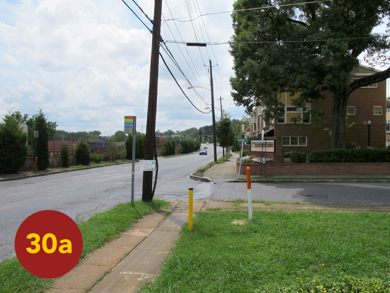
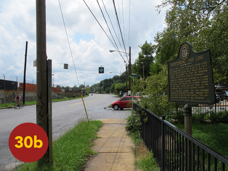
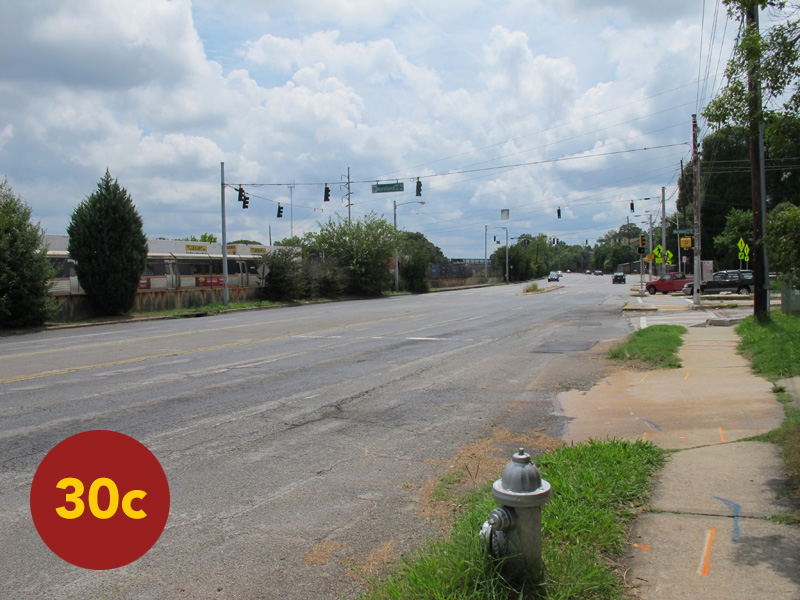
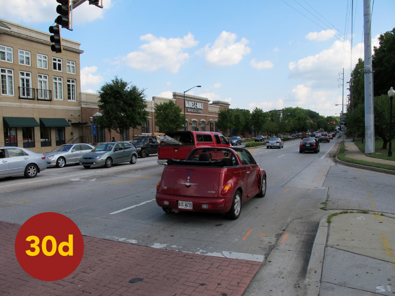
STOP 30—the final tour stop—is the corridor of modern DeKalb Avenue from its interchange with Moreland a quarter-mile to the east. In front of the Candler Park Fire Station (alongside Candler Street) stands the marker: “Logan’s XV Army Corps Line.” From this point south across the CSX / MARTA lines and into the area now dominated by the Edgewood Retail District, Logan assembled a powerful counter-strike. Again, modern DeKalb and the transportation lines follow the same course as the war-time GA-RR / Decatur Wagon Road (which crossed the tracks from north-to-south in this vicinity). Walking west a few hundred feet, locates: “Restoring the Line” @ Elmira Place. This marker records the concluding act of The Battle of Atlanta.
Having just scored a hard-fought victory, the Confederates in the center watched as the Union center re-materialized. Solidified on both right-and-left wings and reinforced, the counterattack went forward. Logan threw at least parts of four divisions at the troops of Brown’s and Clayton’s C.S. Divisions in their front. Though these men fought with the severe intensity inherent of Confederate infantry, they were without reinforcements. The brigades of Manigault and Jones in the very center of the breach did not stand a chance. Logan’s make-shift force surged forward and swept the Confederates out. It was a thick, fierce, bloody fight: the very moment depicted by The Cyclorama. But by 5 p.m., the outcome was assured. Logan’s counterattack regained the original positions of Lightburn and DeGress, with Harrow’s and Woods’ Divisions swinging back in-line on either flank. The gap now closed, the Union line re-fused and strengthened, Hood was forced to pull Cheatham’s Corps back towards Atlanta’s inner defenses.
There was much excitement around Sherman’s HQ about initiating a large-scale follow-up attack with the other two armies under his command, the full force arrayed for the Atlanta Campaign consisting of three: the Tennessee, the small corps-sized U.S. Army of the Ohio and the massive U.S. Army of the Cumberland—over 60,000 strong. But aside from artillery, the latter two were not engaged on July 22, 1864. Sherman begged off the idea of a wider assault. It had been a brutal wearing afternoon for everyone involved. And though such a follow-up attack may have dealt a crushing blow, Hood had already poorly spent his one-and-only army that day. The depleted ranks falling back before the counterattack had been savagely thinned. As was often the case, the attacking force suffered the heaviest casualties, the Army of Tennessee suffering more than twice the amount of men killed, wounded or captured than did the Army of the Tennessee—best estimates contending 11,500 casualties on both sides, in 6 hours time. Their mentioned bravery would be displayed often in the near future, but the Confederate’s “Army of the Heartland” would never be the same …
In a futile epitaph to this day, Hardee’s Corps to the south made a final and somewhat concerted assault against the patchwork Union line. Dug in, compact and reinforced, this line fended off the final attacks of The Battle of Atlanta. Once again, Maney’s and Cleburne’s C.S. Divisions went forward with ferocity and were once again thrown back with bloody results. Hardee called off any further attacks around 6:30 p.m. and the fields fell silent … Over the next five weeks Sherman reversed course to the west / southwest side of the city, using his enormous numerical superiority to continually flank Hood and force him into more disadvantageous fights. The Union armies would eventually use near their full-weight to crush the C.S. Army of Tennessee at The Battle of Jonesboro, severing the final remaining rail-supply-line into the city and forcing its evacuation. Atlanta was surrendered on September 2, 1864.
CONCLUSION
Following our own epic day back in 2004 tracking / tracing the battle throughout the modern city, we settled in on a covered patio in Little Five Points to cool off and enjoy a well-deserved pint. While there, I thought back to a party a friend of mine had thrown during the mid 1990s while renting an apartment just down McClendon in Candler Park. My obsessive interest in Civil War history at the time was well-known to all my friends. I was always urging them to stop and read a state historical marker, often adding a paternal comment like: “and ya’ might just learn something.” I remember that night because my friend made a point of telling me that she’d pulled over just the day before to read a marker on the way home from work; she said: “I stopped and took the time to read it, because you’re always saying I should—and I’m glad I did, because I did learn something” … I can only hope that this ongoing documentary serves likewise.
Special thanks to: Dan Pollock and Emory University’s Southern Spaces “Battle of Atlanta” project, Wilbur Kurtz (“godfather” of modern studies of the battle within the context of the modern city), Georgia Historical Society’s “Georgia Historical Markers Program,” The Atlanta Cyclorama, The Atlanta History Center, Kennesaw Mountain NMP, Pickett’s Mill State Battlefield Park, The WPA Atlanta Campaign Pavilion System, The Washington, Georgia Civil War Roundtable and The Northlake-Barbara Loer Public Library of DeKalb County.
Sources (Volumes):
Carter, Samuel. The Siege of Atlanta, 1864. (New York: Bonanza Books, 1973.)
Castel, Albert. Decision in the West: the Atlanta Campaign of 1864. (Lawrence, KS: University of Kansas Press, 1992.)
Catton, Bruce. This Hallowed Ground. (New York, NY: Simon & Schuster, 1956.)
Catton, Bruce. Never Call Retreat, The Centennial History of the Civil War [Volume 3]. (New York, NY: Doubleday, 1965.)
The Civil War: “Battles for Atlanta, Sherman Moves East.” (Alexandria, VA: Time-Life Books, 1985.)
Voices of the Civil War: “Atlanta.” (Alexandria, VA: Time-Life Books, 1996.)
Connelly, Thomas. The Army of Tennessee, 1862-1865: Autumn of Glory [Volume 2]. (Baton Rouge, LA: Louisiana State University Press, 1971.)
Daniels, Larry J. Soldiering in the Army of Tennessee. (Chapel Hill, NC: University of North Carolina Press, 1992.)
Ecelbarger, Gary. The Day Dixie Died, The Battle of Atlanta. (New York, NY: Thomas Dunne, St. Martin’s Press, 2010.)
Foote, Shelby. The Civil War, A Narrative—Part III: Red River to Appomattox. (New York, NY: Vintage Books / Random House, 1986 [Vintage ed; orig: 1974].)
Horn, Stanley. The Army of Tennessee. (Norman, OK: University of Oklahoma Press, 1993 [Oklahoma ed; orig: 1941])
Scaife, William. The Campaign for Atlanta, 4th Edition. (Cartersville, GA: Civil War Publications [self-published], 1993.)
Sherman, William T. Memoirs. (New York, NY: The Library of America, 1990.)
Woodworth, Steven E. Nothing but Victory: The Army of the Tennessee, 1861-1865. (New York, NY: Alfred A Knopf, 2005.)
Sources (Articles):
“The Augustus F. Hurt House (Civil War Days in Georgia),” by Wilbur Kurtz. Atlanta Constitution Magazine. (June 22, 1930)
“McPherson’s Last Ride (Civil War Days in Georgia),” by Wilbur Kurtz. Atlanta Constitution Magazine. (June 29, 1930)
“Major General W. H. T. Walker (Civil War Days in Georgia),” by Wilbur Kurtz. Atlanta Constitution Magazine. (July 27, 1930)
“At the Troup Hurt House (Civil War Days in Georgia),” by Wilbur Kurtz. Atlanta Constitution Magazine. (January 25, 1931)
“The Broken Line and the DeGress Battery (Civil War Days in Georgia),” by Wilbur Kurtz. Atlanta Constitution Magazine. (February 8, 1930)
“The Siege of Atlanta (Special Atlanta Campaign Edition).” Civil War Times Illustrated. (1964)
Maps
Narrative